


Roasting Ear Voting District, Stone County, Arkansas
About
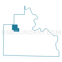
Outline

Summary
| Unique Area Identifier | 528259 |
| Name | Roasting Ear Voting District |
| County | Stone County |
| State | Arkansas |
| Area (square miles) | 13.15 |
| Land Area (square miles) | 13.15 |
| Water Area (square miles) | 0.00 |
| % of Land Area | 100.00 |
| % of Water Area | 0.00 |
| Latitude of the Internal Point | 35.94433810 |
| Longtitude of the Internal Point | -92.29176470 |
Maps


Graphs
Select a template below for downloading or customizing gragh for Roasting Ear Voting District, Stone County, Arkansas


Neighbors
Neighoring Voting District (by Name) Neighboring Voting District on the Map
- Voting District 11-6, Baxter County, AR
- Farris Voting District, Stone County, AR
- Northwest Voting District, Stone County, AR
- Sylamore Voting District, Stone County, AR
Top 10 Neighboring County Subdivision (by Population) Neighboring County Subdivision on the Map
- Sylamore township, Stone County, AR (692)
- Northwest township, Stone County, AR (438)
- Farris township, Stone County, AR (368)
- Big Flat township, Baxter County, AR (198)
- Roasting Ear township, Stone County, AR (149)